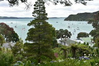
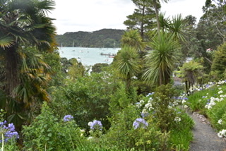
I had a leisurely morning in Auckland on Thursday 12th as the Intercity bus for Paihia didn’t leave until 1pm, arriving at 5.20pm. Such a lovely journey, very countrified and hilly with a nice view as we dropped down into Paihia. It was a 15 minute walk to my motel (Gateway Motel) and a very friendly welcome from Julie, new owner with her partner Martin, who’d come from Sydney, although they were both Kiwis. I was very impressed with my suite which had 2 extra beds (and a sofa bed) surplus to requirements, which was a shame, a huge king size bed in separate bedroom with lots of storage space, a lovely bathroom, kitchenette and dining table. Also provided was a TV and DVD player.
On Friday 13th (😳) I was a bit lazy as wanted to watch some of the BBC election programme, the 12th having been the surprise UK General Election as a result of all the Brexit shenanigans, as usual televised live during the night in the UK which was daytime in NZ. Eventually, after hearing the disappointing exit poll result (a resounding win for the Tories which proved to be accurate later) I ambled into the little town centre and just wandered about getting my bearings, finding out what there was to do over the following week.
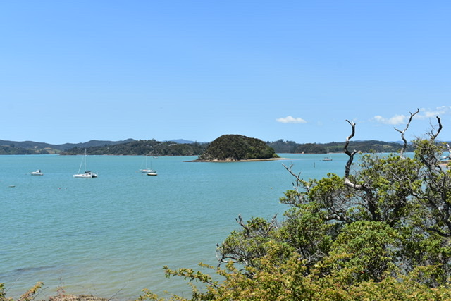
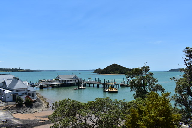
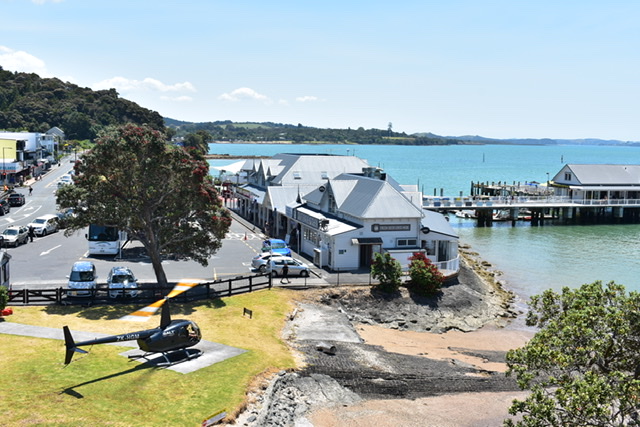
I went into the Fullers office (tours and boat trips) and was served by an older English man who kept picking his teeth and eating whatever he’d picked, rather off putting in a customer service role I thought but I just about managed to stop myself telling him so. I’d loved the Bay of Islands on my Contiki Tour but couldn’t remember where we’d stayed except that it was quite basic and shared rooms. I took a seaplane ride, at that time, over the islands which was fabulous but found out from the tooth picker that seaplanes are no longer allowed in the area but have been taken over by helicopter flights instead.
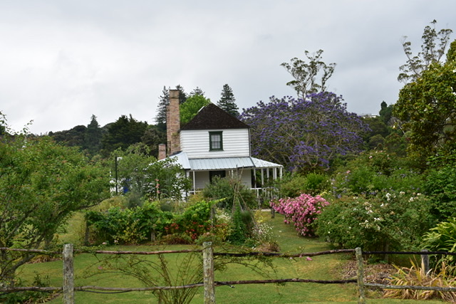
I sat for a while by the beach, reading my book and eating lunch and checked out a stone church (St Paul’s Anglican Church) which unfortunately wasn’t open. It was constructed of Kawakawa stone in 1925 and stands on the site of the original mission church, which had been a simple hut erected in 1823. There was a rather impressive heritage building, now the library, but that had just closed when I arrived so I made a mental note to visit when it was open. This was standing on land that was part of the Anglican Mission Station established by Reverend Henry Williams and his brother, William, in the 1820s. In the grounds was a stone shed which was used in the 1880s as a school room. The house was built in 1920 on the site of the former dwelling and the home of Reverend Percy Temple Williams and his wife Mary. The house was converted into a public library in 2003 but maintains its integrity and character.
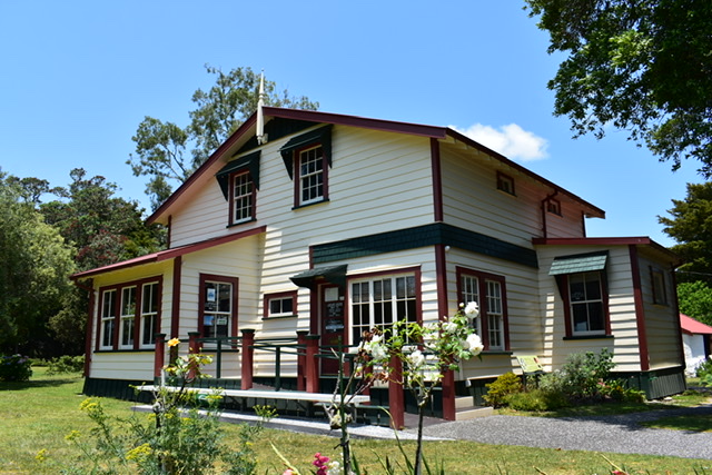
Library 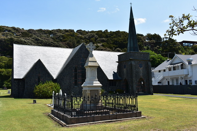
St. Paul’s (Stone) church
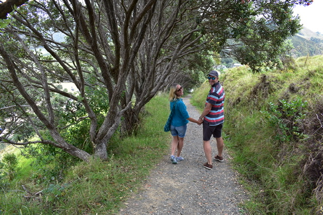
At 9am on Saturday 14th Kate (my friend Pat’s daughter) and son-in-law, Adrian came to pick me up as had invited me to stay with them for the weekend. I’d only met Kate once or twice before very briefly and had never met Adrian. We’d all been looking forward to meeting up and sharing stories as they’d done similar road trips to me. They live in Devon for part of the year and have had a home near Kerikeri for several years, moving to their current home last year in Opito Bay. They came out to NZ this year at the end of September and will be returning to the UK at the end of March. They are about to be granted NZ residency and in order for that to happen have to stay in NZ for at least 5 months each year.
They were keen to take me on a tour and our first stop (after coffee/tea in a lovely cafe which also made wonderful chocolate and handed out samples) was the Old Packhouse market in Kerikeri. Unfortunately it was raining so I didn’t take photos, but it was a really interesting market with some excellent crafts, art and food. I really enjoyed wandering round and even bought something: a small Christmas pudding.
We then went to the Stone Store and Kemp House at Kerikeri Mission Station, two of NZ’s most significant buildings in beautiful grounds on the banks of Kerikeri basin. National Trust membership got me free entrance and as soon as we arrived there was a tour of Kemp House by a Kiwi woman called Heather, taking me and a couple round. Kate and Adrian had done this before so went off for a walk. Kemp House, a wooden Georgian-style building, was built by missionaries in 1822 and is NZ’s oldest building. The area was one of the first places in NZ where Maori invited visitors to live among them. The Stone Store, built in 1832, was originally a Missionary Society warehouse but later assumed various roles including a trading post, library, barracks and boys’ school and is now used mainly as a gift shop with some lovely items for sale.
Kemp House 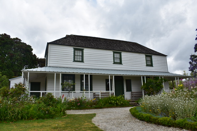
Kemp House
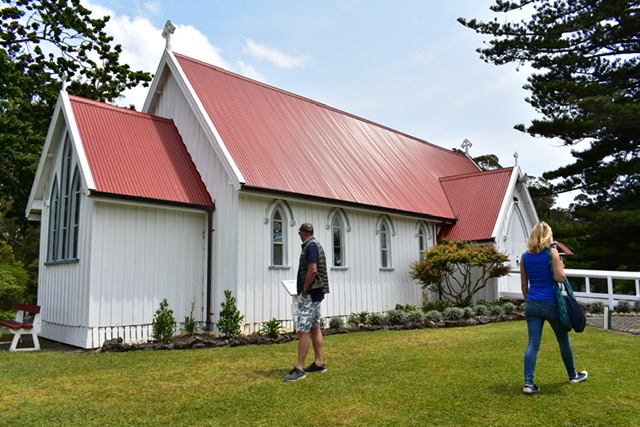
Nearby was St James Church:
Within the grounds was a lovely pub/restaurant, ‘The Plough and Feather’ where I was treated to a lovely fish and chip lunch.
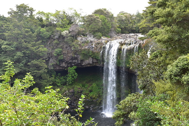
Next stop was Rainbow Falls, where we did a short walk to the waterfall although today there was no rainbow:

Then it was a lovely drive to Kate and Adrian’s fabulous house (I knew it would be) in Opito Bay, surrounded by huge glass windows with one side facing the east bay and the other west so they can see sunrises and sunsets.
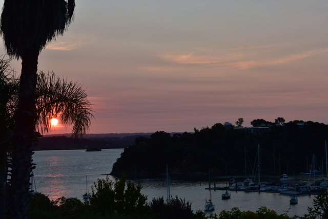
Sunset, view from Kate & Adrian’s home 
View east from Kate & Adrian’s home
They have made friends with many of their neighbours, have a boat and jet ski.
Kate had made a lovely vegetarian moussaka which we washed down with some nice white wine, then sat and watched the film ‘The Piano’, which I’d seen when it first came out years ago but had completely forgotten what it was about (well, of course!) but didn’t think much of it.
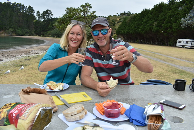
On Sunday we had a nice breakfast outside on the deck and then a picnic lunch was packed up and I was taken on another tour, this time in Adrian’s jeep that he’s very proud of and recently had the wheels replaced with huge ones.
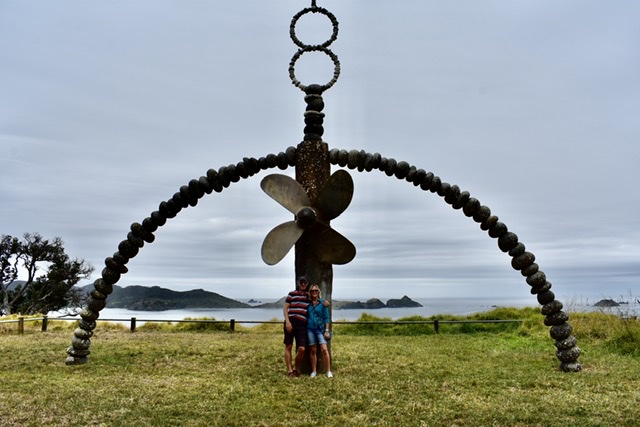
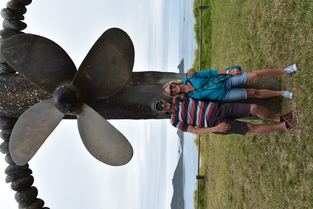
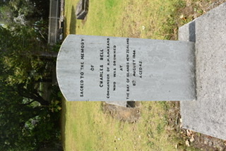
Rain was forecast but it held off. We went to Matauri Bay, a popular summer destination, and walked up a steep hill to see the Rainbow Warrior memorial which was created by sculptor, Chris Booth, between 1988 & 1990 to commemorate the sinking of the Greenpeace ship by French agents in 1985 during which a photographer was killed. The ship itself is sunk in the area and is a popular dive spot.
Rainbow Warrior Memorial, Kate and Adrian:
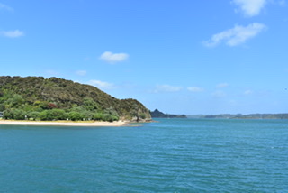
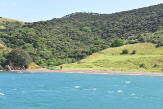
Next stop was Tengaere Beach and on to Mahinepua Bay where we had our picnic:
Our final stop was at Whangaroa where Kate and Adrian knew a nice cafe for a cuppa but, sadly, it was closed. There was another, not quite so salubrious cafe, where we were served by a very bored and slow young woman. Kate and Adrian then dropped me back at my motel and I felt I’d got to know them rather well and had such an enjoyable time with them. They are such lovely and good people, it was a real joy to be in their company and I shall look forward to seeing them again, either back home or in the South Island where they plan to travel next year.
On Monday morning I walked to the Waitangi Treaty Grounds, just along from the motel, which I’d visited 26 years ago but couldn’t remember much about except that it certainly wasn’t on the scale it is now. It’s NZ’s most important historic site where, on 6 February 1840, 43 Maori chiefs (after much discussion) signed the Treaty of Waitangi with the British Crown which led, eventually, to over 500 chiefs signing it. The site is situated on a headland, and has been transformed over the past 26 years. I spotted a cruise ship in the bay and hoped that the passengers wouldn’t coincide with my visit.
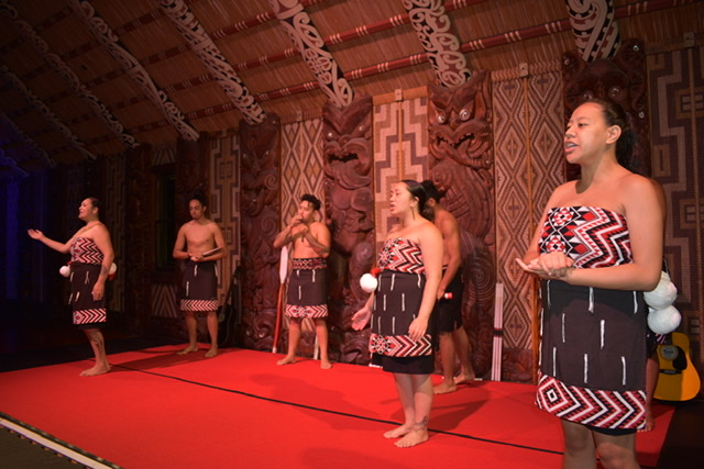
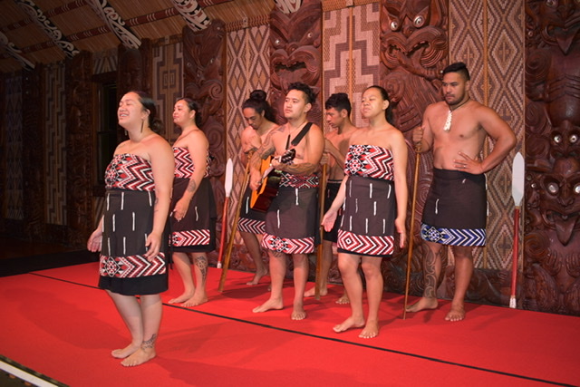
As soon as I’d paid my entrance fee I was put with the 10am tour which had just set off. The Maori guide we had I think thought he was being funny with his delivery, a kind of patronising drawl, which came across as if he was talking to a group of schoolchildren, funny initially but annoying by the end and I discovered that a few people on my tour joined another one later. We were taken to see the large war canoe that had been built for the centenary of the treaty signing in 1940. In fact it’s the largest ceremonial war canoe, 37.5m long holding up to 150 paddlers. It’s launched every year in February to commemorate Waitangi Day when thousands of people attend. After 50 minutes of that we were led to a meeting house, also built and carved for the centenary celebrations, where there was a 30 minute cultural performance and, very much like the Rotorua event I attended, started outside with a welcome and then inside where a man in our group had been selected to act on our behalf to thank the Maoris for their welcome. An enjoyable performance of poi (swinging pom poms used by the ladies), games (throwing and catching sticks), weaponry, haka and singing. For some reason I found it very emotional, despite not being able to understand a word they were singing about.
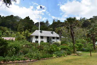
The Treaty House (in front of which, on the lawn, the treaty had been signed marked by a flagpole) had originally been shipped over as a kit-set from Australia and erected in 1834 as the 4-room home of the official British Resident (British Government’s representative) James Busby where he conducted much of his business from 1833 – 1840. It was later extended and is a memorial and museum containing displays about the house and people who lived there. By 1934 the house was derelict but was bought and gifted, by Lord and Lady Bledisloe, to the people of NZ and restored.
The grounds were lovely and the new museum, opened in 2016, was impressive. There was an interesting 20 minute film on the history of Waitangi and a re-enacted film of the actual discussion and signing of the treaty. Also a woodcarving studio with a carver in action and a large gift shop which I looked at but didn’t spend money in. I thought that the entrance fee of $50 was money well spent.
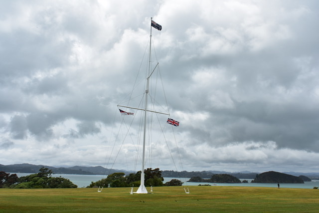
Flagpole 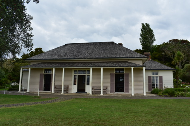
Treaty House 
Back of Treaty House 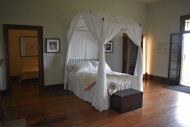
Inside Treaty House 
Grounds 
War canoe 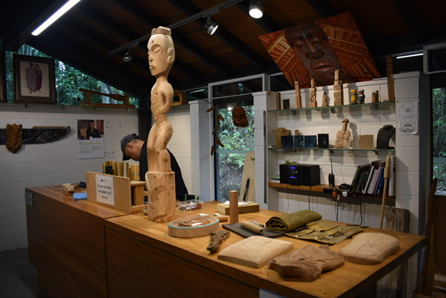
Wood carving studio
I’d booked to go on a coach tour with Fullers to Cape Reinga on Tuesday (Te Rerenga Wairoa in Maori), the most northern part of NZ, despite the weather forecast promising 100% rain. I thought it would be the best day to sit on a coach for a few hours. I’d had the opportunity of doing this tour 26 years ago but chose to go on the seaplane flight instead so had it in mind to do it this time.
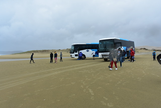
I was picked up by the nearly full coach outside my motel at 0745. Julie had thoughtfully placed a big brolly outside my room (which later blew inside out in the strong wind and bent). A large percentage of the passengers were Japanese but there were a few other nationalities too. We were one of two coaches doing the tour, on Christmas Day there are 5 booked out already.
We had a lovely Maori driver/guide called Hugh (Hoinga – his Maori name) and he sang songs in Maori to us at various points, the first being a welcome song, which I thought was a nice touch. He gave an almost constant commentary, as he drove, of various points of interest or Maori customs, just a shame only a small percentage of the passengers could understand. He explained that given the bad weather and the fact the tide was coming in, he needed to get up to Ninety Mile Beach (a highlight of this tour) earlier than normal. After about 90 minutes of travelling we stopped at Awanui for 30 minutes where there was a cafe and gift shop of mainly furniture and products made from ancient kauri, unique to NZ. In the middle of the gift shop was a 50 tonne piece of kauri with a staircase carved inside leading to a top floor gallery:
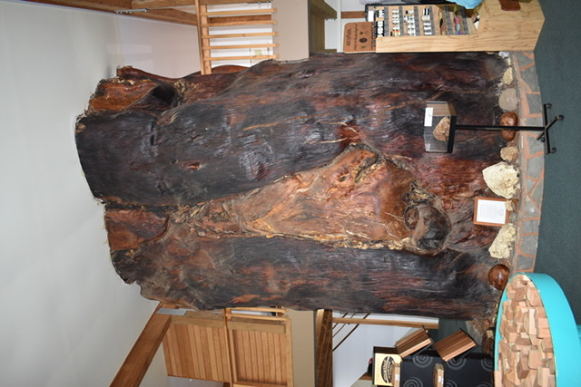
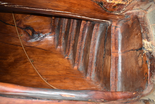
The Kauri trees used here have been extracted from the earth where they’ve laid for thousands of years. The kauri tree that was used for this staircase was extracted from a local farm in October 1994 and radiocarbon dating has confirmed it was perfectly preserved in the swamp for 45-50,000 years! The estimated weight of the tree was 140 tonnes and the largest swamp kauri log known to have been extracted. The staircase was created by Dave Stewart in 1998 using a 50 tonne section. The shop was built around the staircase. The staircase itself took Dave 300 hours to chainsaw out and 2 other men an additional 200 hours to finish it.
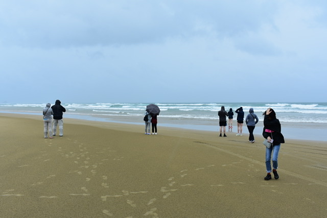
Then it was a drive onto Ninety Mile Beach (which is actually 88km long) on the west coast lined with sand dunes. Hugh said he couldn’t stop as the coach would sink. As we drove along, for quite a way, the tide appeared to be getting closer. All the while the rain was pouring but I thought it was quite exhilarating and a magical experience, and some of the Japanese ladies got quite excited, oohing and aahing in the childlike way they sometimes do. We saw two hardy cyclists pedalling along in the opposite direction, not quite the cycle ride I’d choose. There was the chance we might see wild horses galloping along the beach but we weren’t in luck. Hugh stopped the coach at Te Paki Stream, which is the only place the beach can be accessed from the north.
We drove along the stream (and here a lot of private motorists can get stuck in the sand) and stopped beside a big sand dune. Another highlight is sand boarding, and a few brave souls got out to do it, not including me. At the bottom of the sand dune was a huge pool of rainwater but it was fun watching people zoom down the dune on body boards and splash through the water at the bottom. Some had come prepared wearing shorts and a change of clothes, but not all. I’m sure I’d have given it a go had the conditions been different.
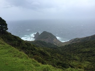
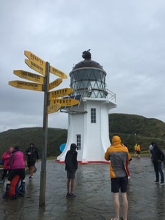
Then it was a drive to Cape Reinga and a walk to the northern most lighthouse. This headland is where the Tasman Sea meets the Pacific Ocean. For Maoris the male sea meets the female sea, and the point where the currents clash represents the creation of life. It’s also an important place for Maoris as they believe the spirits of the dead depart the world from here. Kupe (according to Maori legend, the first Polynesian to discover NZ in about 925) saw this place as the point from which his people would return to their distant homeland after death. Hugh had sung us another Maori song on the way for anyone who had been bereaved, telling us that a sister of his died recently and a brother 3 years ago.
The walk was about 500m on a fairly new path and the wind was very gusty, blowing the big umbrella Julie had lent me inside out rendering it useless, with driving rain. Still it had to be done to see the northernmost lighthouse in NZ. The lighthouse signalled from 1878 – 1940. On the rocky point could be seen an ancient tree, known locally as a kahika, which has survived in seemingly impossible conditions – on a rock face lashed by salt winds. The westerly point was name Cape Maria van Diemen by Abel Tasman in 1643 after the Governor’s wife in the Dutch East Indies where his voyage had begun.
View from walk to lighthouse 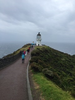

Cape Maria van Diemen 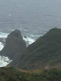
Kahika tree on rock face
We then drove to our lunch stop as a choice of fish and chips or falafel and salad had been included in our tour. I sat and chatted with an Indian couple, now living in Toronto, Canada, and their nice 12 year old son who was born in Canada. We then went back to the kauri furniture shop/cafe mainly so that Hugh, and the driver of the other coach, could wash the saltwater off the coaches acquired during the beach drive.
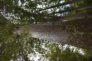
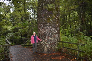
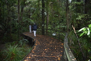
Our final stop was Puketi Kauri Forest, a little way off the main drag, where about 3% of the original kauri forest remains and one of the best remaining examples of the subtropical rainforest which once covered northern NZ. There was a short circular boardwalk through part of the forest where the biggest Kauri tree stands:
On Wednesday I did another Fuller tour, ‘The Cream Trip’ (boat trip) which, together with yesterday’s tour was a combo tour and discounted. This was the first tour which began in 1936 when Albert Fuller acquired the Cream Trip, with facilities to transport cream, that operated between the islands and the mainland. The Cream Trip route:
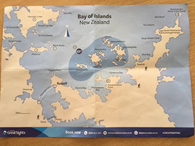
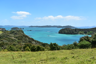
Fortunately the boat wasn’t full and I sat on the top deck for most of the day. We left Paihia at 9.30am, picking up some more passengers at Russell, just across the bay. It was another windy day and the Captain, who was very entertaining and also our guide giving us lots of information, told us that he’d be heading as quickly as possible, owing to the windy conditions, to the Hole in the Rock, which is a highlight and usually the last stop before heading back to Paihia. He told us that hopefully we’d see bottle nosed and/or common dolphins along the way. Apparently a fairly recent rule has come out preventing sightings of bottle nosed dolphins before midday (difficult if you do happen to spot them!) because numbers have been decreasing and babies dying and it’s not known why. It’s also no longer allowed to swim with dolphins, something I nearly did in Kaikoura (South Island) all those years ago but couldn’t because of bad weather.
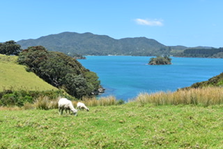
We went past Moturoa (no.3), the second largest island in the bay and a sheep farm. Motu = island in Maori. Then nearby were the black rocks (no.4) an extensive chain of unusual volcanic basalt rocks, populated with bird rookeries and interesting flora. Another place these can be found is in the Galápagos Islands. We then saw the Marsden Cross (not on an island but Rangihoua Bay no.5), a stone cross marking the spot where the Reverend Samuel Marsden held NZ’s first Christian sermon on Christmas Day in 1814. The area was then home to a prominent Maori chief called Te Pahi.
Another island (I forget which) had been home to the Mountain family, one of the earliest settler families, who introduced a cannery for the canning of fish. A house on the island was stayed in by Barack and Michelle Obama when they visited last year and by Prince Charles and Camilla on their recent visit.
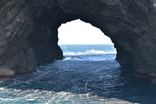
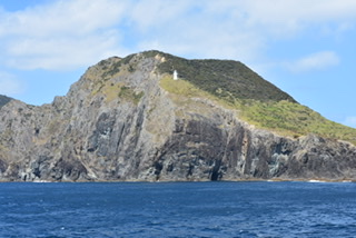
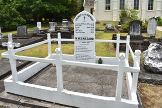
We then headed up to Motukokako or Hole in the Rock (no.14). It was incredibly windy on the way there having been somewhat sheltered on the western side of the bay. Captain Cook named this Pierce Island. The hole is 18 metres high and in good weather the boat can go through it but not this day. Nearby is Cape Brett Peninsula with its lighthouse which was built on the Coromandel Peninsula, barged up the coast and winched into place. Lighthouse keepers lived there from 1910-1978 when a new automated light went into service.
We saw some dolphins just before midday, so we had to wait until 1200 to to officially ‘see’ them! They followed our boat for some time and certainly to Otehei Bay (no.10) where we stopped for lunch. This is the southern end of Urupukapuka Island (no. 11) the largest island in the bay and a recreational reserve and farm park of approx 520 acres with many beautiful beaches and walking trails. American author Zane Grey (never heard of him but apparently he wrote western novels) lived in Otehei Bay in the 1920s. His popular book ‘Tales of the Angler’s Eldorado’ made game fishing in the Bay of Islands world famous.
I ate the falafel and salad lunch I’d ordered, on the grass and then did a short walk up a hill which afforded some lovely views around the bay. We had 80 minutes here then back on the boat. Soon after, a net was strung out attached to two booms on one side of the boat and most of the younger passengers, wearing their swimming gear, jumped into it. The engine was revved up and water rushed over them, pushing them around the net which they struggled to hold on to at times. This went on for some time and was fun to watch.
By the time we got back to Paihia it was after 4pm and I felt the trip had been maybe an hour too long, however both that and the Cape Reinga tour were excellent value so I was glad I’d done them.

Black rocks 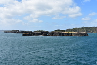
Black rocks 
Marsden Cross 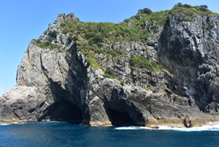
Hole in the rock 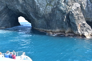
Cape Brett Lighthouse 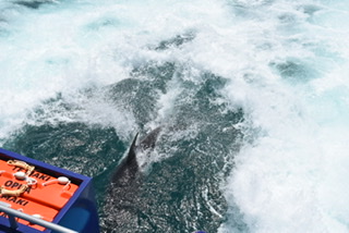
Dolphins 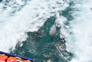
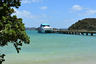
Our boat at Otehei Bay 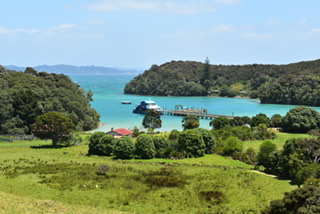
Otehei Bay 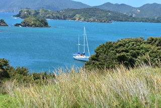
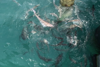
Snapper & bream 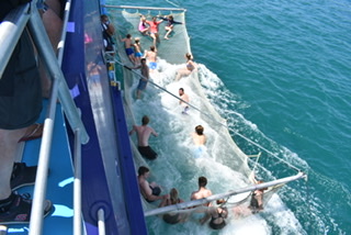
Boom netting
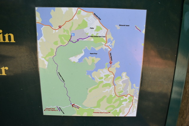
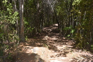
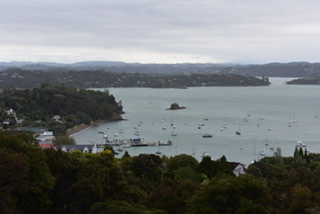
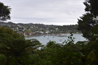
On Thursday I decided to do a walk, having sat on my bottom for most of the past two days. The walk started along School Road. As per the map (mauve marked trails) I walked initially to Paihia Lookout, mainly uphill which took about 30 minutes, then followed the Oramahoe Traverse track which was up and down all the way, taking me over an hour. Although it was a nice track to walk (apart from tripping on a few tree roots) there was nothing to see as it was in the bush. At the end it just led to an unsealed road, so quite disappointing from that aspect. I retraced my steps and it became a bit of a route march which I just wanted to get to the end of. At least it was exercise though and not the worst walk I’ve done.
Walking track 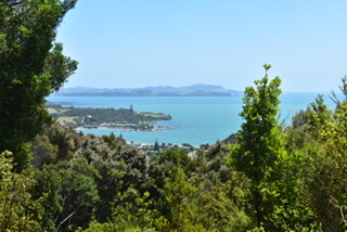
From Paihia lookout 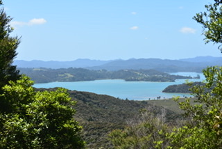
From Paihia lookout
At the end of the walk I felt I deserved lager at a nice bar next to the wharf, which was called ‘Zane Grey’.
Friday 21st was my last day in Paihia so I decided to go to Russell, just a 10-15 minute ferry ride from Paihia, depending on which ferry you get as one is faster.
First stop was a nice cafe for tea and toast and on first arriving I thought how much it reminded me of Devonport, across from Auckland, again very tranquil and olde worlde. Russell was originally the capital of New Zealand and during Captain Cook’s second voyage became known as the ‘Hellhole of the Pacific’ owing to the orgies that went on on the beach between sailors and Mauri women. Graeme Lay describes it in his 2nd book in the trilogy on Cook ‘James Cook’s New World’.
I then went to the Museum which, although small, was very good with the usual Maori artefacts and a 5th size model of ‘Endeavour’. After that was Christ Church, NZ’s oldest church (Anglican) which was built in 1835. I enjoyed wandering around the graveyard where some early settlers, sailors and whalers were buried and memorials to Maori people of note….


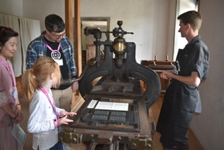
Pompallier Mission was next. This was named after Bishop Jean-Baptist Pompallier who, from 1839, established the first French Catholic mission headquarters to NZ and the Western Pacific on the site. The Printery/tannery is all that remains of a once crowded Mission site which has been restored to its original form and is NZ’s oldest surviving industrial building. There was a guided tour and my guide was Angel, a young English guy hailing from Purley, Surrey. He told me he’d been living in NZ on and off for 2 years and hoped to become a resident. He wasn’t the most knowledgeable nor fluent guide I’ve ever had but he did his best and can only improve. This was the place where Catholic texts were translated from Latin into Maori, printed and books bound with leather covers that were made here also. Apparently 40,000 were printed in 8 years. Angel guided us around the house starting with the preparation of animal skins ready for tanning, then the printing press (one by Gaveaux made in 1840), and the bookbinding process.

The gardens were created in the late 19th & early 20th centuries by the families whose home this site eventually became (also the people responsible for demolishing the other Mission buildings) and are now maintained as they were originally created. There was a path up to a lookout point with good views:
By this time it was afternoon tea time, so I went back to the cafe I’d visited earlier. Then it was a walk to the opposite side of Russell on the east where there was a nice sheltered beach: Oneroa Bay. A short walk around the headland led to Waitata Bay.
Oneroa Bay, Russell 
Waitata Bay, Russell
I then walked to Flagstaff Historic Reserve which was up a steep road. It was here that, in 1834, the influential Ngapuhi (local tribe) Chief, Hone Heke, presented a flagstaff to the British Resident at Waitangi, James Busby, which was to fly NZ’s first flag: the Flag of the United Tribes. Eleven years later the flagstaff became the focus of protest and fighting between Maori and British and was chopped down 4 times by Hone Heke. There were more good views over Russell and across the bay to Paihia with a mostly woodland walk back down to the town.
Two interesting buildings on the The Strand, Russell’s main street, fronting the wharf are ‘The Gables’, a restaurant built in 1847, and the Duke of Marlborough Hotel which has apparently been “refreshing rascals and reprobates since 1827” and holds NZ’s first liquor licence.

The Gables 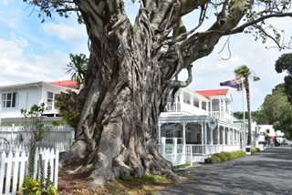
Duke of Marlborough Hotel
I got the ferry back to Paihia and was just walking to the motel when I gradually caught up with a woman with grey hair and a big backpack on her back. I chatted to her and discovered she was French, her English and my French not being brilliant. She was looking for a particular camp site that she’d been told was along the road where my motel was. I suggested she accompany me to ask Julie. We had a nice chat and she told me her name was Chrystelle. I thought she was pretty brave not only carrying her huge backpack (which I’d done at her age – 48 – and older) but also a tent and all the paraphernalia that goes with camping.
Julie didn’t know the camp site but rang them to discover it was 5km along the road. She suggested I borrow her car to drive her but that wouldn’t have helped her get about the next day. Julie then realised there was another camp site just along from the motel so we walked Chrystelle there.
The next morning (Saturday 21st) as I was packing in order to check out at 10am, Chrystelle turned up needing to use WiFi. She was supposed to be woofing (volunteering on farms) and rang one of her contacts, who couldn’t take her as it was Christmas, but fortunately she’d been given another contact, who happened to be French, in Kerikeri, and arranged to meet him later that afternoon. There was a bus there but she was planning to hitchhike. She had told me that she lived in Erp, in the French Pyrenees, had a son and knew how to look after cattle and could sheer sheep.
I said my goodbyes to Julie, and pretty sad to be going as we’d got on very well and had a lot of chats. Martin kindly gave me a lift into town as I had 3 hours to kill before getting my bus to Albany. I went in the library for a while and got some lunch then on the bus for the next adventure.
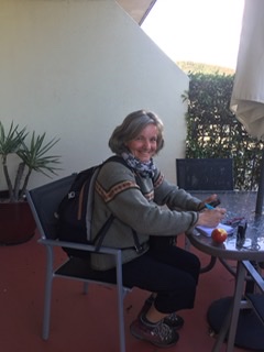
Chrystelle 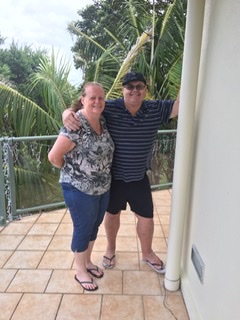
Martin and Julie
